

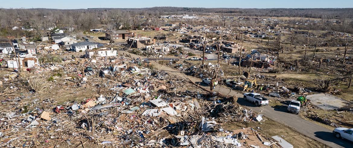
An aerial view of damage in Dawson Springs, Kentucky, after a tornado outbreak in Dec. 10-11, 2021. (Courtesy of National Weather Service/Chris Conley)
The warning time before a tornado touches down is measured in minutes. Long-term planning on sunny days when tornadoes aren’t a threat is crucial for preparing for and recovering from these storms.
Research led by Eren Ozguven, director of the Resilient Infrastructure and Disaster Response Center (RIDER) and a professor at the FAMU-FSU College of Engineering, examined demographics, infrastructure and more than seven decades of weather data to determine which places in Kentucky are most vulnerable to these natural disasters.
The research was published by Sustainability.

“Tornadoes hit quickly, so preparing for them is key,” Ozguven, said. “You need to have plans ready, on an individual and government level. Our research shows where these storms are likely to have the greatest impact on people.”
Ozguven’s team used geographic information systems software to combine variables such as frequency of tornadoes, transportation infrastructure, household income and other factors to determine where populations are likely to have the resources to be more resilient and where these storms will be more disruptive.
The information they found can help local and state governments identify regions with vulnerable communities and fragile transportation networks, helping to pinpoint where finite resources can be used most effectively for handling debris, community preparedness and other recovery and preparation endeavors.
The team analyzed data from Kentucky because of the state’s history with tornadoes, including a 2021 outbreak in western Kentucky that killed more than 50 people. But the methodology could be expanded to other places, including Florida, Ozguven said.
The places affected by tornadoes are changing as climate change alters the frequency, intensity and location of these storms. That makes up-to-date information about where they are most likely to hit and cause major impacts important for planning. The Florida Panhandle saw multiple tornadoes in January 2024 that caused destroyed homes, toppled trees and injured several people.
Further development of the methodology created by Ozguven and his team could also incorporate the damage caused by tornadoes, creating a fuller picture of the disruption caused by these storms.
This project was funded by the Natural Hazards Center, a National Science Foundation information clearinghouse for the societal dimensions of hazards and disasters.
Co-authors were Mehmet Burak Kaya, a graduate research assistant at RIDER, Onur Alisan, a postdoctoral researcher at RIDER, and Alican Karaer, a former doctoral student at RIDER who is now a researcher at Iteris.
RELATED ARTICLES
Researchers at FAMU-FSU Engineering use metric-specific technology to keep seniors safer on the road