

Over the years, the cataclysmic nature of hurricanes has resulted in devastation throughout Florida.
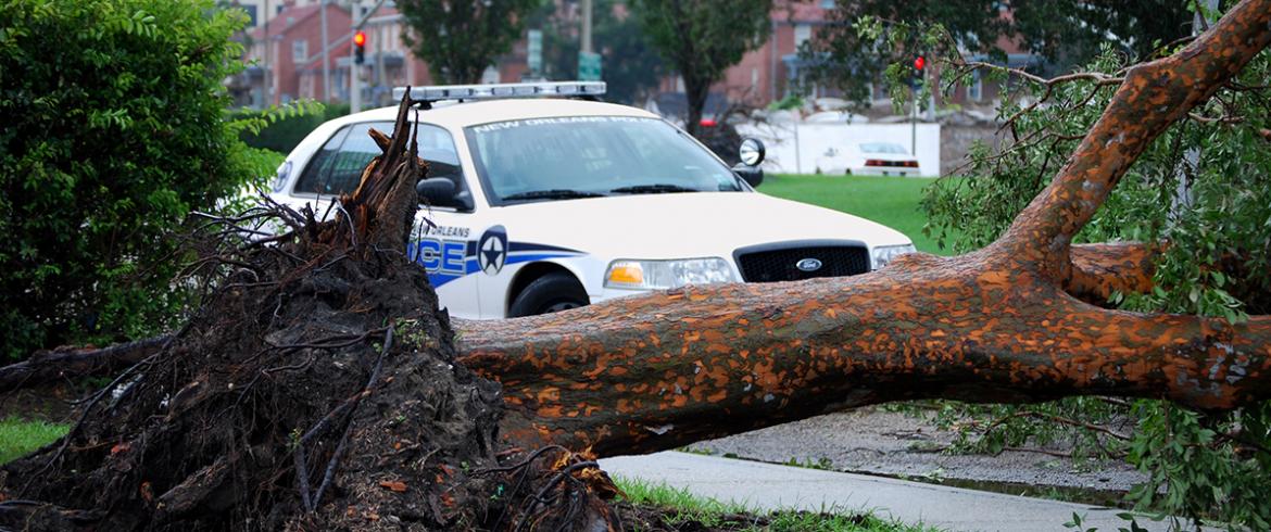
Immediately after a storm, road closures in metropolitan areas due to fallen power lines and large trees increase the amount of time it takes first responders to reach a destination during natural disasters, when lives are at stake.
To counteract this major issue where conserving every second is imperative, FAMU-FSU civil engineering professor Eren Ozguven, Ph.D. led research on a project to create a new metric called the Accessibility Decrease Index (ADI), measuring the changes in accessibility for emergency response facilities during and in the aftermath of hurricanes. This metric could be used to inform the response plans for any municipality with a risk of hurricane impact.
To measure the change in emergency response travel time (ERTT), Ozguven and a team of graduate students and professors from the FAMU-FSU College of Engineering studied the accessibility of emergency response facilities such as police stations, fire stations and hospitals within Tallahassee city limits.
Florida’s capital is particularly susceptible to the winds and rains of storms because of its 55 percent tree coverage, one of the highest in the nation. The area also is home to 78 miles of canopy roads.
The research team conducted sensitivity analyses to discover which roadways have a higher likelihood of closing due to massive fallen objects during hurricanes.
In order to conduct their study, the civil engineers used convolutional neural networks (CNN), an image processing technique that identifies the types of trees in high-resolution satellite pictures.
“Based on the impact of the wind on trees, we can calculate their failure probabilities, and then translate this into a closure probability of a roadway,” said Ozguven. “If a certain type of tree is more susceptible to wind impact, the roadway next to that tree has more risk to be closed.”
They evaluated roadway disruption probabilities under different hurricane wind scenarios, identifying critical roadways emergency response facilities should use for hurricane preparation and in the midst of a crisis.
By the end of their research, Ozguven and his team were able to display regions in Tallahassee with reduced emergency response facility accessibility as well as roadways under a disruption risk. Now, county officials can locate areas of interest in danger of closing and improve emergency response plans.
In the Sunshine State hurricane research is critically important. Last hurricane season, Category 5 Hurricane Michael wreaked havoc upon Puerto Rico and the Florida Panhandle, resulting in 47 deaths and over $15 billion in estimated damage.
Ozguven’s project is a novel study.
“This has not been done before,” he said. “Others are also trying to create the link between trees and ‘power lines and roadways’, but due to data availability – which we get from the City of Tallahassee in terms of power outages and roadway closures – they cannot find this. Also, hurricanes are rare events and it is not easy to find enough data.”
The study lasted from September 2016 through December 2017 after Hurricane Hermine had passed. The research was supported by the United States Department of Transportation and administered by the Center for Accessibility and Safety for an Aging Population (ASAP).